# (C) British Crown Copyright 2017, Met Office
#
# This code is free software: you can redistribute it and/or modify it under
# the terms of the GNU Lesser General Public License as published by the
# Free Software Foundation, either version 3 of the License, or
# (at your option) any later version.
#
# This code is distributed in the hope that it will be useful,
# but WITHOUT ANY WARRANTY; without even the implied warranty of
# MERCHANTABILITY or FITNESS FOR A PARTICULAR PURPOSE. See the
# GNU Lesser General Public License for more details.
#
# Plot station pressure and reanalysis ensemble for each station
import iris
import DWR
import numpy
import collections
import matplotlib
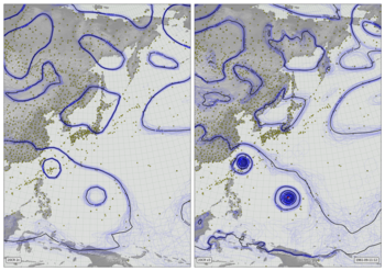
[docs]def plot_scatter(ax,field,dwr_obs,dte,**kwargs):
"""Make a mslp contour plot with DWR observations
Args:
ax (:`cartopy.axes`): Axes to hold the plot
field (:obj:`iris.Cube.cube`): Reanalysis mslp ensemble
dwr_obs (:obj:`pandas.DataFrame`): DWR observations.
extent (:obj:`list`) Plot extent (lon.min,lon.max,lat.min,lat.max)
xlabel (:obj:`str`): 'x-axis title'
Kwargs:
pressure_range (:obj:`list`): (min,max) pressure for scatterplot, default [945,1045].
xlabel (:obj:`str`): x-axis label for scatter plot, default 'MSLP (hPa)'.
scatter_point_size (:obj:`float`): Size of ensemble dots in scatter plot (pts), default 25.
scatter_alpha (:obj:`float`): Alpha transparency of ensemble dots in scatter plot (pts), default 0.5.
stations (:obj:`list`): Names (DWR format) of stations to be included, default is stations in dwr_obs.
station_latlon (:obj:`dict`): Latitiudes and Longitudes of stations to be included, default is taken from dwr_obs.
|
"""
# Set keyword argument defaults
kwargs.setdefault('pressure_range',[945,1045])
kwargs.setdefault('xlabel','MSLP (hPa)')
kwargs.setdefault('scatter_point_size',25)
kwargs.setdefault('scatter_alpha',0.5)
kwargs.setdefault('stations',list(collections.OrderedDict.fromkeys(
dwr_obs.loc[:,'name']).keys()))
if 'station_latlon' not in kwargs:
latlon={}
for station in kwargs.get('stations'):
latlon[station]=DWR.get_station_location(dwr_obs,station)
kwargs['station_latlon']=latlon
# x-axis
ax.set_xlim(kwargs.get('pressure_range'))
ax.set_xlabel(kwargs.get('xlabel'))
# y-axis
ax.set_ylim([1,len( kwargs.get('stations'))+1])
y_locations=[x+0.5 for x in range(1,len( kwargs.get('stations'))+1)]
ax.yaxis.set_major_locator(
matplotlib.ticker.FixedLocator(y_locations))
ax.yaxis.set_major_formatter(
matplotlib.ticker.FixedFormatter(
[DWR.pretty_name(s) for s in kwargs.get('stations')]))
# Custom grid spacing
for y in range(0,len(kwargs.get('stations'))):
ax.add_line(matplotlib.lines.Line2D(
xdata=kwargs.get('pressure_range'),
ydata=(y+1.5,y+1.5),
linestyle='solid',
linewidth=0.2,
color=(0.5,0.5,0.5,1),
zorder=0))
# Plot the station pressures
interpolated={}
for station in kwargs.get('stations'):
try:
interpolated[station]=DWR.at_station_and_time(
dwr_obs,station,dte)
except Exception:
interpolated[station]=None
for y in range(0,len(kwargs.get('stations'))):
station=kwargs.get('stations')[y]
if interpolated[station] is None:
continue
mslp=interpolated[station]
ax.add_line(matplotlib.lines.Line2D(
xdata=(mslp,mslp), ydata=(y+1.25,y+1.75),
linestyle='solid',
linewidth=4,
color=(1,0,0,1),
zorder=1))
# for each station, plot the reanalysis ensemble at that station
interpolator = iris.analysis.Linear().interpolator(field,
['latitude', 'longitude'])
for y in range(0,len(kwargs.get('stations'))):
station=kwargs.get('stations')[y]
ensemble=interpolator([kwargs.get('station_latlon')[station]['latitude'],
kwargs.get('station_latlon')[station]['longitude']])
ax.scatter(ensemble.data,
numpy.linspace(y+1.25,y+1.75,
num=len(ensemble.data)),
kwargs.get('scatter_point_size'),
'blue', # Color
marker='.',
edgecolors='face',
linewidths=0.0,
alpha=kwargs.get('scatter_alpha'),
zorder=0.5)